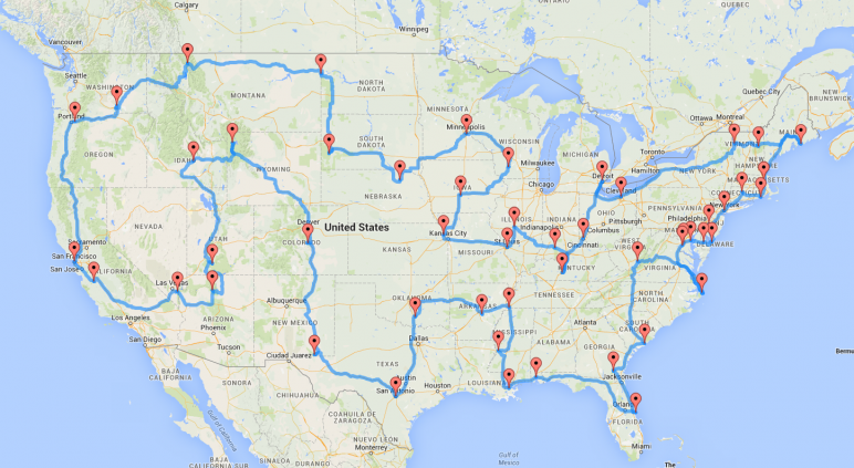
This map on Facebook caught my attention this morning.
It was generated by a doctoral student at Michigan State named Randy Olsen, who came up with a computer algorithm to find the most efficient route between 50 landmarks in all 48 contiguous states. The article behind the map states that it would take at least 2 months to do this on a motorcycle.
I’m game… any other takers?
Looks like too many interstate routes to me (to be interesting/fun). But then, it IS supposed to be efficient….
I want to know the most inefficient way for a cross country road trip–no interstates, just country roads. That’s what I would want to do……….and would do……..if I didn’t have to work to feed kids and pay bills. LOL